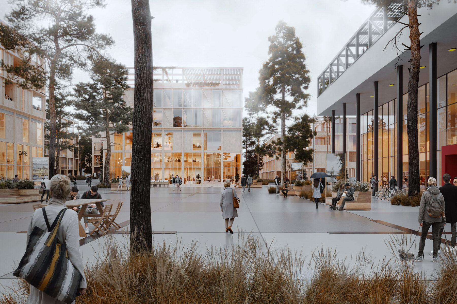
ECHO Urban Design developed a future vision for the centre of Kaarina: a sustainable, socially inclusive and ecologically resilient town centre where nature, mobility and urban life are seamlessly interconnected.
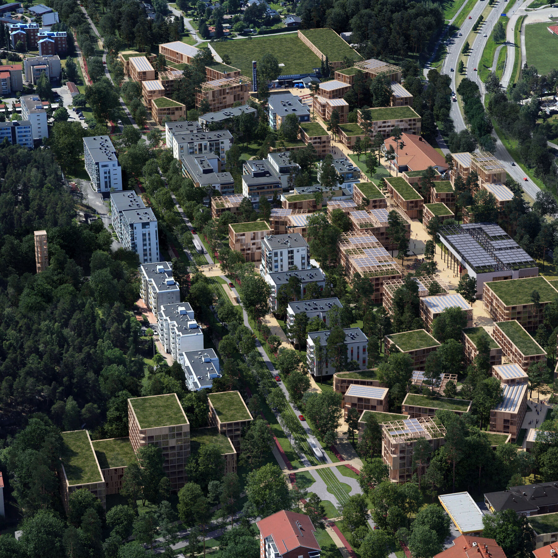
The proposal transforms the existing centre into a vibrant forest city, where the scale and character of the surrounding landscape guide urban development. By weaving the city and the forest together, the plan creates a healthy, attractive and climate-resilient environment for residents, visitors and local ecosystems.
Client:
Municipality of Kaarina
Design:
2023
Type:
Masterplan
Status:
International design competition
Gross floor area:
120.000 m2
Partners:
Raivio Bumann, Finch buildings, Planetary Architecture, VERO
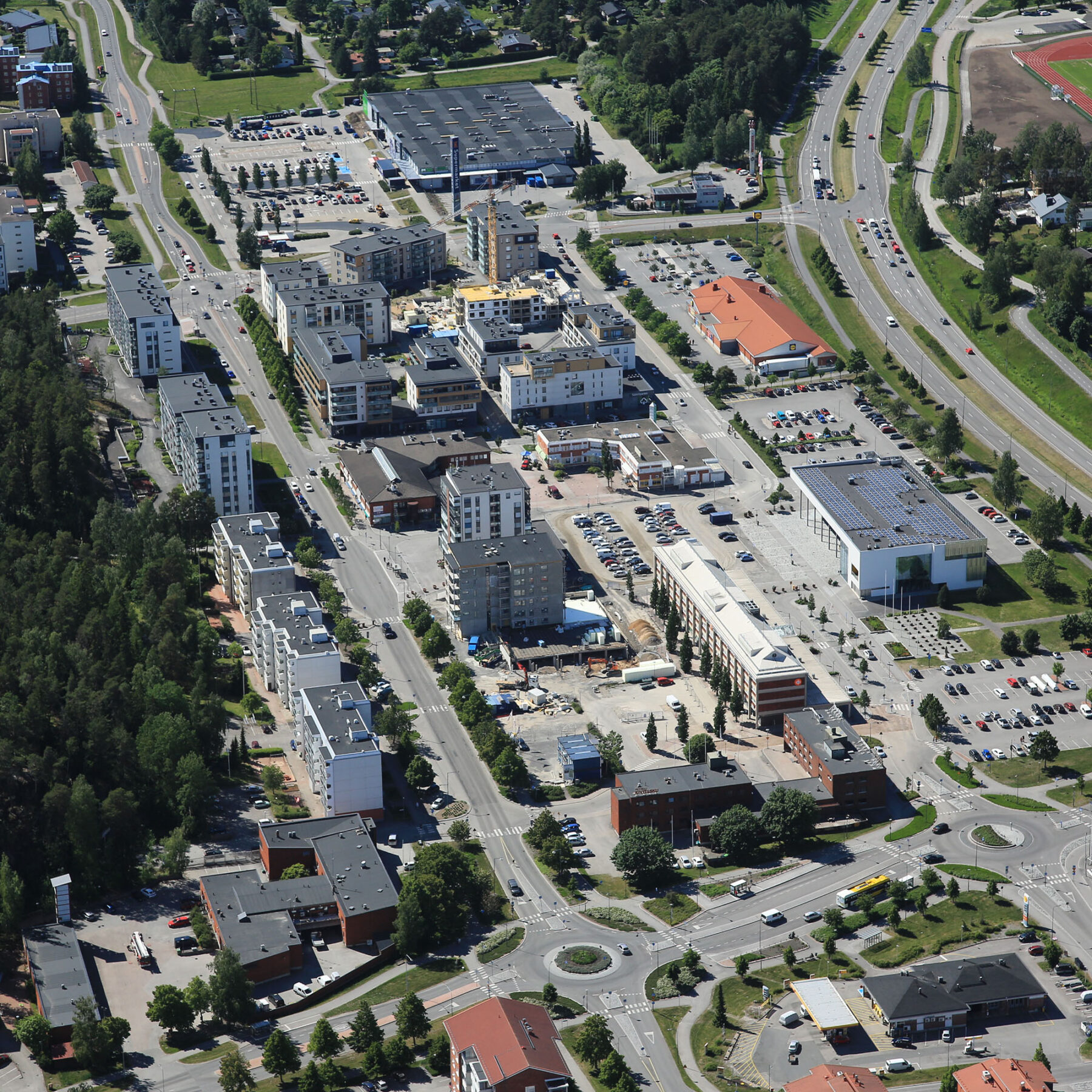
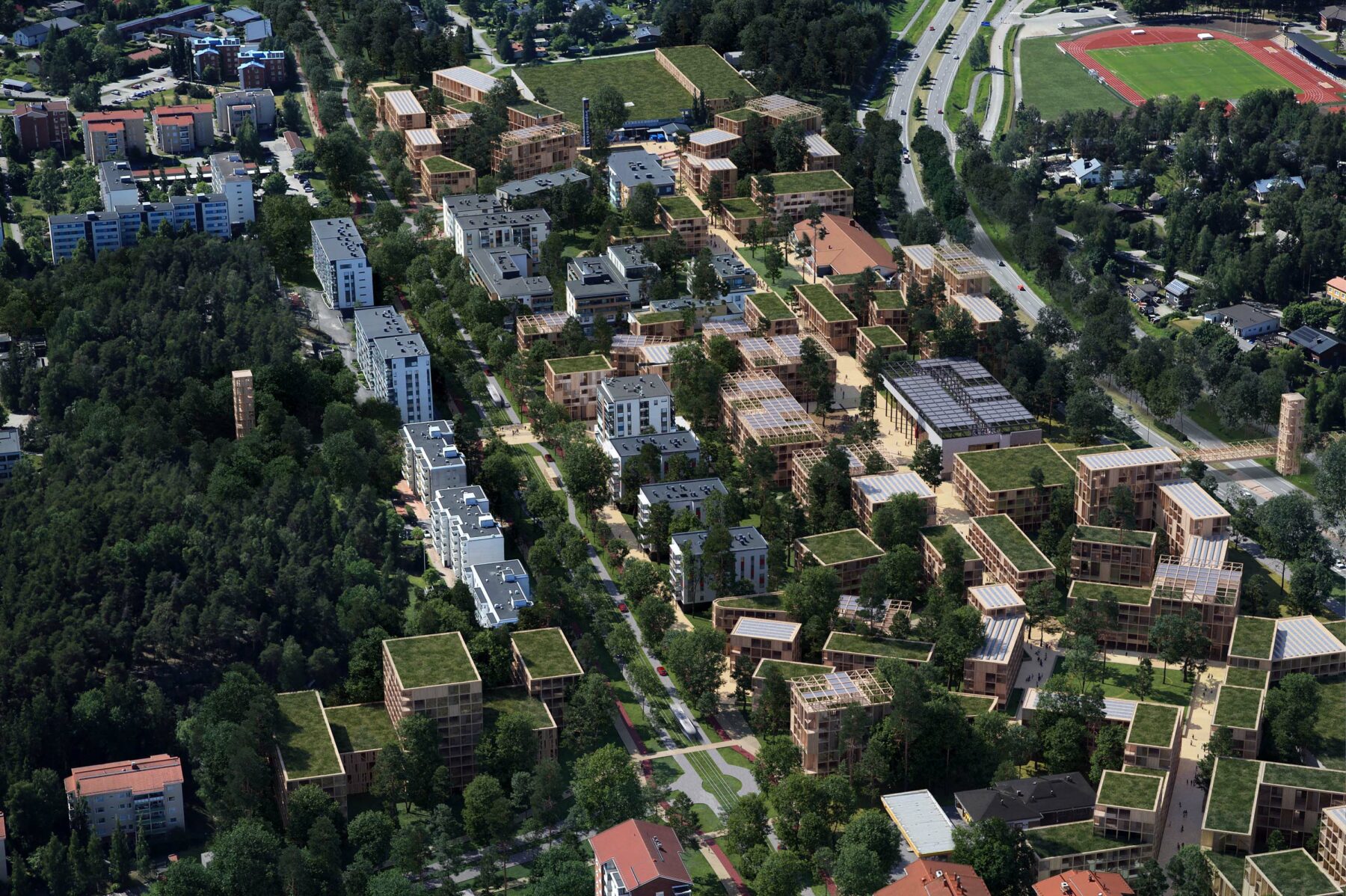
Existing situation (aerial view) – 2023New town centre vision – 2023
Design and spatial structure
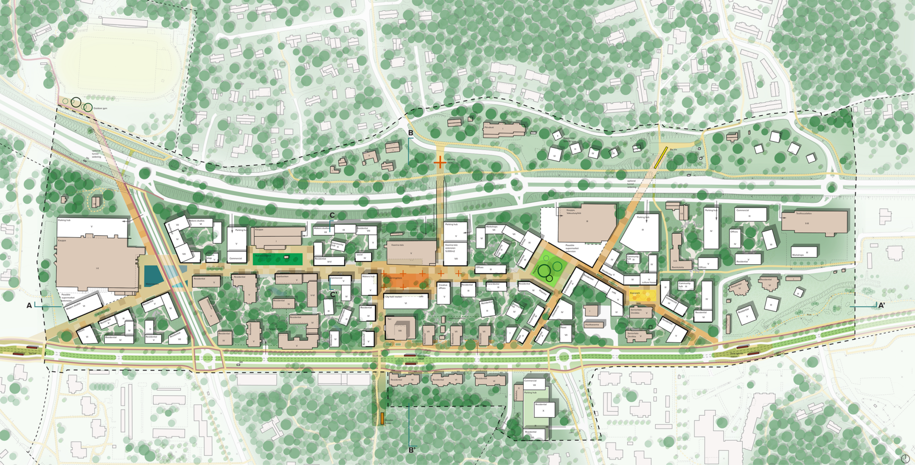
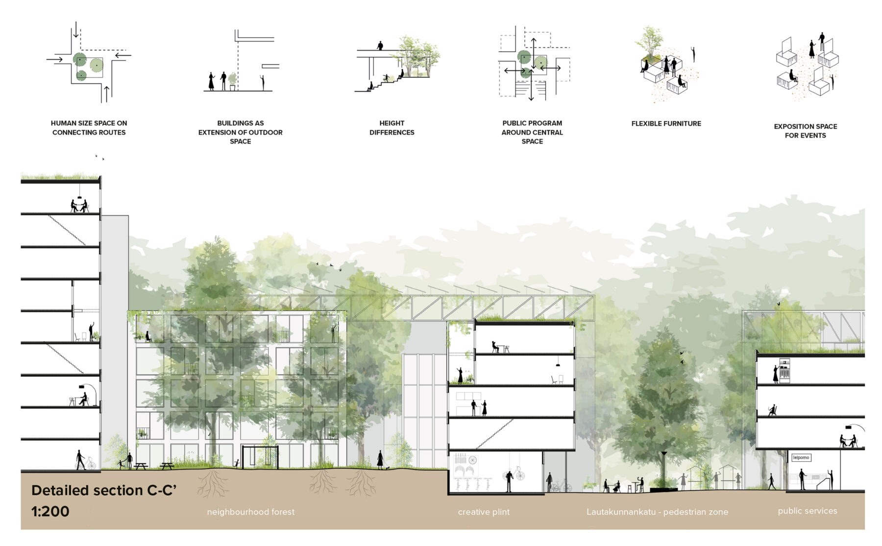
The masterplan builds upon Kaarina’s forested landscape. Large green areas are connected through ecological corridors, generous public green spaces and a fine-grained network of pedestrian and cycling routes, creating a cohesive urban landscape where nature becomes an integral part of everyday life.
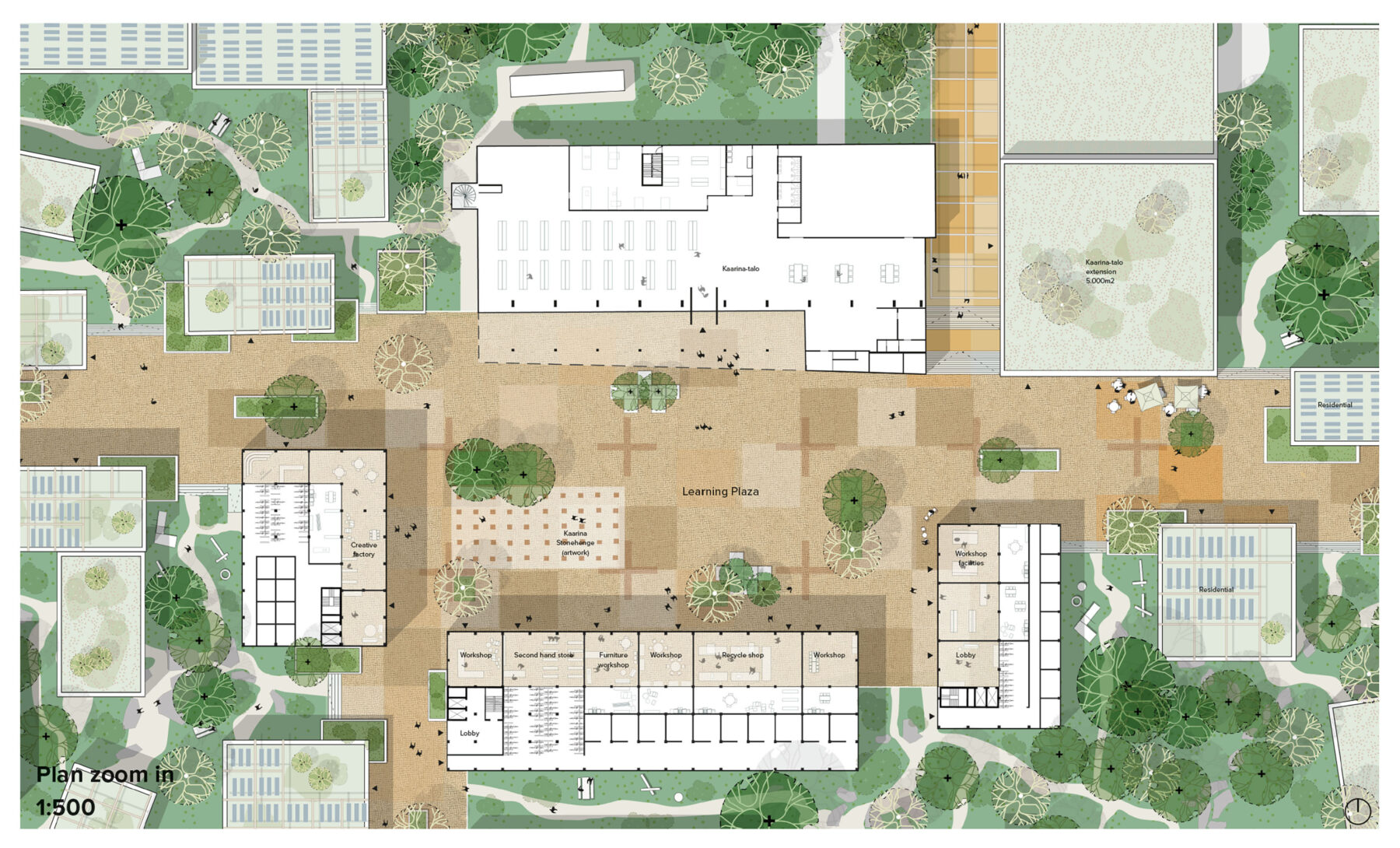
The town centre is organised around a sequence of public spaces and squares, each with its own identity and atmosphere. Around Kaarina-talo, a lively civic heart emerges from which pedestrian routes, meeting places and public amenities extend throughout the area. A varied composition of urban blocks, freestanding buildings and civic functions creates a diverse urban fabric that encourages social interaction and active public life.
Car-free town centre
The construction of the western bypass and strategically located mobility hubs along the northern edge of the site makes it possible to significantly reduce car traffic in the town centre. This creates more space for pedestrians, high-quality public spaces and a vibrant, people-oriented urban environment.
Accessible by light rail
In addition to the existing bus network, a new light rail connection between Kaarina and Turku is proposed. By locating the stops at strategic points, the route creates an attractive pedestrian spine that guides residents and visitors through the town centre.
Active mobility network
The town centre is connected to the surrounding neighbourhoods at multiple scales through an integrated network for walking and cycling. A series of loops of varying lengths links the area to existing pedestrian and cycling routes, while missing connections—such as a new pedestrian bridge across the MT110—complete the network and improve accessibility throughout the city.
Forest biotope
The forests and green spaces surrounding Kaarina are given greater room to grow and evolve. The urban design concept builds upon the existing natural landscape, strengthening the relationship between the town and its surrounding environment. This creates a healthy and attractive living environment for both people and wildlife, with a continuous ecological network and sheltered habitat corridors for a wide range of species.
Village city
The open arrangement of existing and new buildings invites exploration and creates a distinctive sense of place. A mix of (semi-)enclosed urban blocks, freestanding buildings embedded within the forest landscape, and landmark civic buildings forms a flexible urban structure for Kaarina’s future. Human-scaled architecture, carefully integrated among the trees, reinforces the close relationship between people and nature.
Social fabric
A network of pedestrian and cycling routes, public spaces and civic buildings connects the town centre to public transport, walking trails and regional cycling routes. This social fabric supports everyday life while strengthening connections between different parts of the town. Four thematic destinations form the backbone of the masterplan, encouraging interaction, learning and well-being through spaces dedicated to food, learning, movement and experimentation.
Mixed-use programme
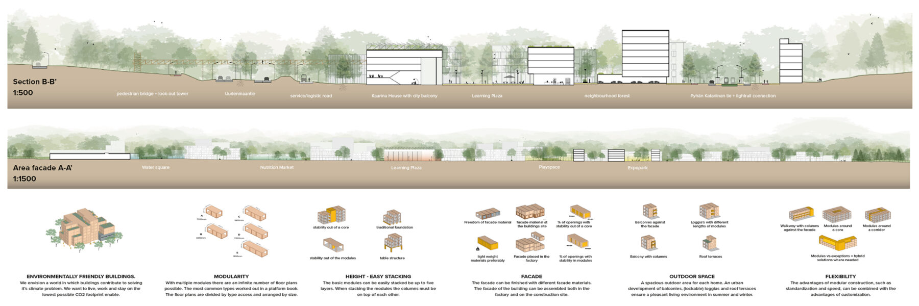
Kaarina is envisioned as a mixed-use town centre where living, working, learning, entrepreneurship and recreation coexist. An interconnected network of streets, squares and public amenities encourages social interaction and strengthens community life. Five thematic public squares form the backbone of the programme.
Each square focuses on a specific theme—water, food, learning, play and culture—giving the centre a series of distinctive destinations. Active ground floors with retail, cafés, workplaces and public facilities ensure a vibrant and lively urban environment throughout the day.
Landscape, biodiversity and climate resilience
Landscape and ecology form the foundation of the masterplan. The surrounding forests are integrated into the urban structure through green connections, creating a robust ecological network that enhances biodiversity while providing space for both people and wildlife.
The plan places a strong emphasis on sustainable mobility. New pedestrian and cycling routes connect the town centre with surrounding neighbourhoods, while a future light rail connection between Kaarina and Turku will significantly improve regional accessibility. Strategically located mobility hubs support a low-car town centre, creating more space for public life, recreation and social interaction.
Modular timber buildings contribute to low-carbon construction while allowing for flexible future development. Sustainable building principles, energy-efficient solutions and climate-adaptive public spaces together create a resilient town centre that can evolve in response to changing needs.
Process and phasing
The masterplan proposes a phased development strategy for the transformation of Kaarina’s town centre. The first phase focuses on the area surrounding Kaarina-talo, where new housing, public amenities and high-quality public spaces will be introduced. Subsequent phases expand the town centre through new infrastructure, sustainable mobility solutions and further urban development, enabling the centre to grow gradually over time.
Phase 1
The first phase focuses on the area surrounding Kaarina-talo. New housing, public and commercial amenities, and a mobility hub are developed on municipally owned land and sites identified for redevelopment. At the same time, the first stage of a pedestrian-friendly public realm is delivered, including a new connection to the northern part of the town centre.
Phase 2
The second phase builds on the introduction of the light rail connection and strategically located mobility hubs near key amenities. This enables the reconfiguration of the transport infrastructure while creating opportunities for the town centre to expand at strategic locations. By separating Paraistentie from the MT110, a continuous east–west pedestrian-oriented public space is created through the heart of the centre.
Phase 3
The final phase enables continued organic growth through the use of modular buildings, allowing new neighbourhoods to develop flexibly over time and across different locations. The public realm is completed as a continuous network, connecting all neighbourhoods of Kaarina into one cohesive and integrated urban landscape.